
Finding Who Lives Along a Milford Street
A Milford street directory cannot begin with the assumption that an owner, a voter, and a household member are the same person. Begin with the parcel and add records in order. The goal is a careful address trail, not a single label. MapXpress gives the current assessment snapshot. SearchIQS gives the recorded-document chain. The voter lookup, a historical directory, or a permit can add a dated clue when its limits are stated.
Use this address walkthrough for a street or one house:
- Confirm the canonical street spelling in the official Milford street list, then enter the house number and street in MapXpress.
- Save the MBL or parcel ID, owner of record, situs/location address, mailing address, assessment date, and map links from the card.
- Open the GIS viewer and click the target parcel, then the touching or opposite-frontage parcels when the question concerns a block.
- Search SearchIQS by grantor and grantee, using the parcel, street, date, book/page, and document type to keep similar names apart.
- Use the official voter form only for an exact person and lawful civic question, then compare a historical directory or library source for an older household.
The final note should say what each source actually shows. “The assessment card lists this owner” is safer than “this person lives here.”
Milford Street MapXpress Search Fields
The Milford MapXpress property search is the main address tool in a street directory. It exposes a partial owner-name field, a house number, a street dropdown, and a parcel ID field. There is no ZIP search field. Select a street when the goal is to browse several parcels, or combine House No and Street for one focused card.
| Label | Type | Required | Format or behavior |
|---|---|---|---|
| Property Search Name | Text | No | Partial owner search; Smith is the form example. |
| House No | Text | No | Enter a house number and pair it with Street. |
| Street | Dropdown | No | All Streets plus Milford street names. |
| Parcel Id | Text | No | Example format 065 321 18. |
| Go | Button | - | Runs the municipal property search. |
The result grid can expose MBL/owner/address, a picture, quick links, and a map link. Parcel details may lead to Quick Map, Summary Card, VISION, Assessor Map, FEMA Firm Panel, and the GIS view. Assessment data is updated nightly according to the research, while parcel maps were updated in June 2026. Keep the source date with a saved result.
The inspected Milford parcel card shows the practical distinction. It lists owner SMITH AARON J & CHRISTINA C &, situs 0 BURWELL AVE., and mailing 21 BURWELL AVENUE, MILFORD CT 06460. Those are three separate fields, not one residence claim.
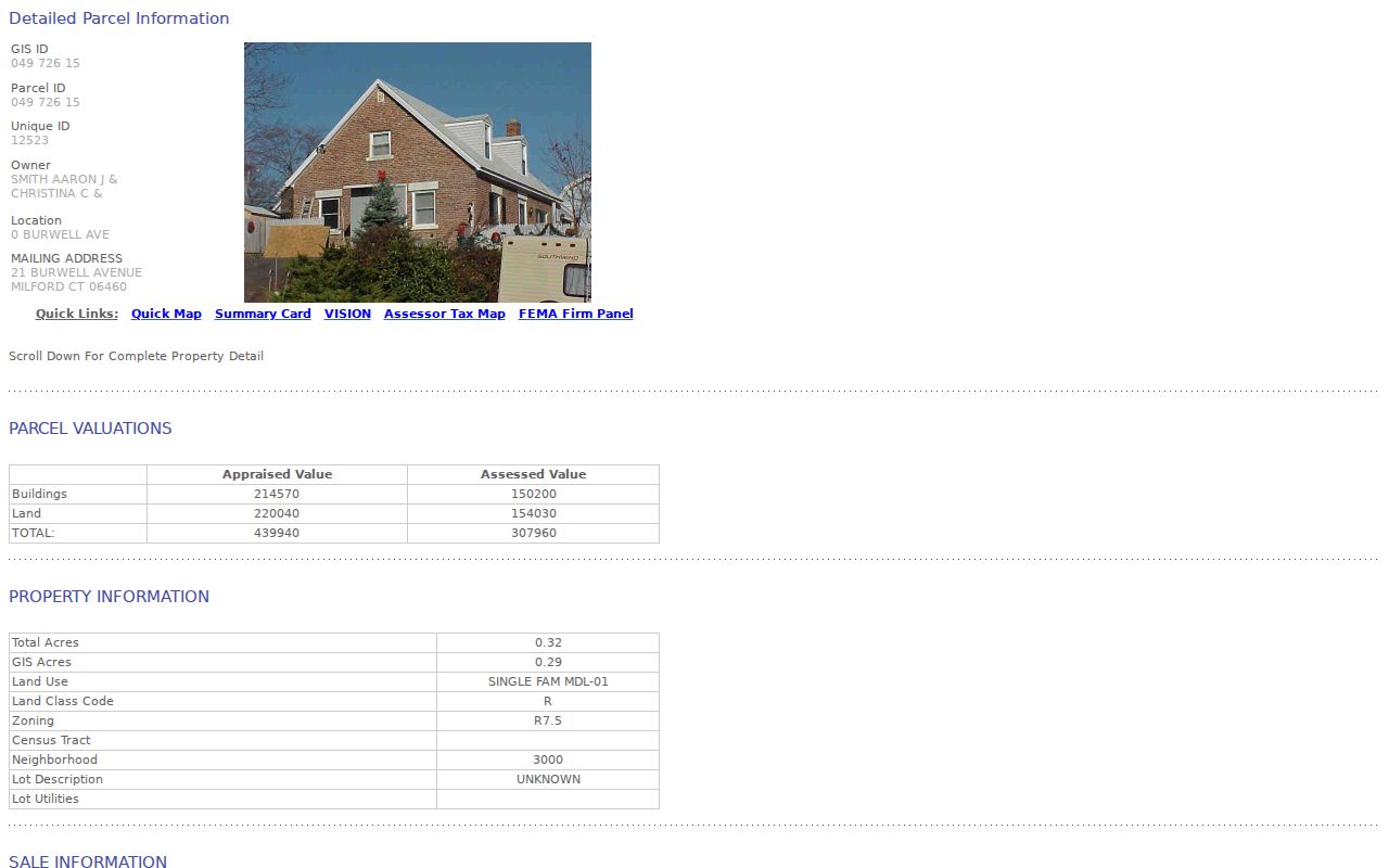
The parcel card is a useful street-directory starting point because it preserves the MBL, values, building fields, and source links beside the address distinction.
Milford Address Owner, Situs, Mailing
The Burwell example is not just a data detail. A situs address identifies where the parcel is mapped. The assessment mailing address is where the bill or notice is sent. An owner field identifies the name carried on the tax record. A street directory should display those labels rather than compressing them into “resident.” A person may own a parcel, receive mail elsewhere, or appear in a different record at another date.
- Parcel
- A mapped unit of land with a municipal identifier and assessment record.
- Situs address
- The physical location assigned to the parcel in the property system.
- Mailing address
- The address used for assessment correspondence, which may differ from the situs.
- Plat or map
- A recorded or assessment drawing that helps place lots, lines, and streets.
- Criss-cross directory
- An address-keyed historical directory that can connect a house or street to a name when a volume includes that index.
These definitions also matter when a ZIP label, court property address, or old directory entry does not match the current card. The mismatch is a prompt to compare sources, not proof that one source is wrong.
Milford Records Searchable by Street
Several Milford records can be tied to an address, but they answer different questions. The coverage table below keeps a street search from becoming an overbroad resident list. The City Clerk owns the deed path, the Assessor owns the parcel snapshot, and the Registrar of Voters does not offer a public street-browse mode.
| Record set | Keeper | Street-level clue | Access |
|---|---|---|---|
| Property assessment | Milford Assessor | Owner, MBL, situs, mailing, values, building and sale fields | MapXpress public search |
| GIS parcel layer | Milford MapXpress | Touching parcels, frontage, zoning, flood, wetlands, and district context | Interactive public viewer |
| Deeds, liens, and maps | Milford City Clerk | Recorded parties, instruments, dates, book/page and image trail | SearchIQS, counter, mail or phone |
| Voter lookup | Secretary of the State | Exact name and town registration result | Official form, no street browse |
| Permits and tax notices | City departments | Dated project or billing clues tied to a document | Archive, department, or FOIA route |
A parcel ID can connect MapXpress to SearchIQS and map references. The street name can normalize the address across the city list, GIS, court property search, and a library directory. It cannot make an owner into an occupant or turn one court address into a current block roster.
GIS Layers Along a Milford Street
The Milford MapXpress GIS viewer adds space to the street directory. Use parcel info on the target polygon, then click an adjoining polygon and save each MBL and owner/situs link. The viewer offers parcel, aerial, zoning, flood, wetlands, historic-district, coastal, sewer, environmental, FEMA, district, and planimetric layers, along with measure tools and multiple orthophotography vintages.
The layer list is context, not title evidence. A zoning or flood layer can explain why nearby parcels differ. An aerial image can help align an old street shape. A parcel polygon can show adjacency. None of those layers proves a personal relationship, an occupancy fact, or a legal boundary survey. The downloads page says the data is provided as is, so cite the municipal viewer and the date viewed.
The tax-map gallery supplies revision and disclaimer material, while the GIS viewer supplies the live click path. Together they are better for a whole street than a single property card.
Milford Street Deeds by Grantor
SearchIQS is the recorded-document side of the street directory. Modern land records and images run from January 3, 1967 forward. Maps begin July 17, 1875, trade names begin January 6, 1986, and foreclosure registrations begin May 16, 2022. A deed chain can connect a street parcel to prior parties, but a recorded party may no longer own or occupy it.
For a current parcel, search the owner as grantee, then follow the earlier grantor. Narrow by recording date, instrument type, book/page, and legal description. If the trail reaches 1966 or earlier, switch to the historical INDEXBOOKS route, choose Grantor or Grantee, search the spelling variants, record the section number, and then move to that section. The City Clerk at 203-783-3210 is the practical help route for an unclear index or certified copy.
The SearchIQS Milford coverage note is useful for the date boundaries. The modern image set and historic index books are not one continuous interface, even though the City Clerk's vault reaches back to 1639.
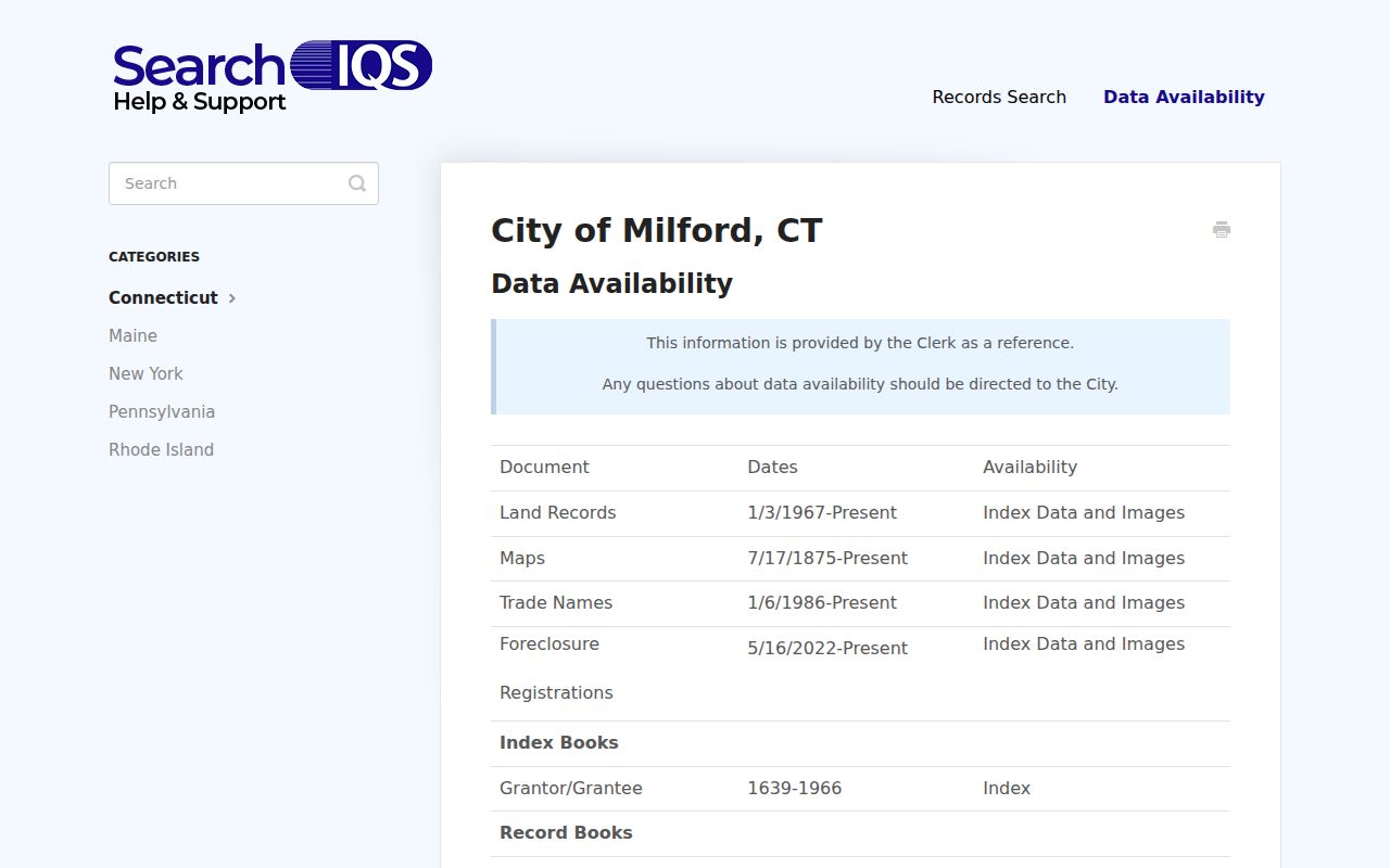
The SearchIQS capture supports a careful description of the collection tabs and the separate historic name-search route.
Milford Street Permits and Tax Notices
Milford's public building-permit archive posts monthly documents, with observed coverage from at least January 2025 through July 2026. The Online Permitting Center routes building, zoning, and inland-wetlands submissions to City Squared and says an account is required. A posted permit can name an address, applicant, owner, architect, or contractor in the document, but it is not a complete historical street index.
The Tax Collector handles real estate, motor-vehicle, personal-property, and sewer bills. Its legal-notice page can add a dated name or address clue. No unrestricted name-browse tax roll was located. Use the department or a Milford FOIA request for a narrowly described older file, and label a billing notice as a tax record rather than an occupancy record. The Milford tax-notice source shows why dated documents belong beside, not inside, the main parcel record.
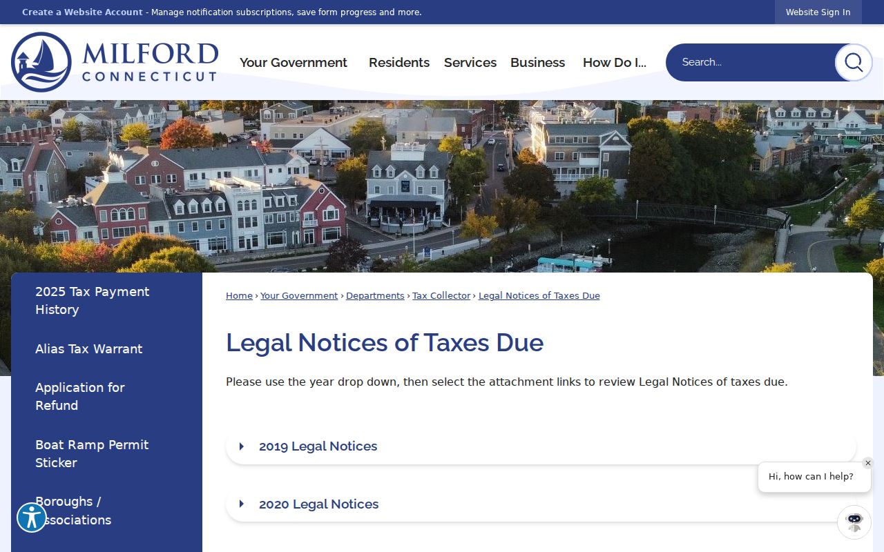
A legal notice can help place an event in time while leaving the current owner and household question open. The Milford building-permit archive is a second address clue, with its own date and document limits.
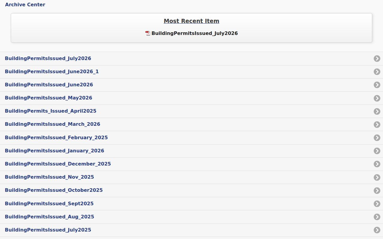
The permit archive is a public file shelf, not a promise that every older permit is posted or searchable by name.
The Milford Street List and Old Names
The official Milford streets page is the canonical spelling source for a modern street directory. It includes names such as Ansantawae Road, New Haven Avenue, Ocean Avenue, Orange Avenue, Park Avenue, and Pearl Street among a much longer list. The older street-map PDF is a useful orientation aid, but it should not be treated as proof of current geometry or a complete resident register. Historic directories may shorten “avenue” to “av” or use another abbreviation. When an old address does not match the live dropdown, preserve the old form, compare neighboring entries and cross streets, inspect a Sanborn sheet or deed legal description, and ask the library or City Clerk about a local street-name change. No official city-wide renumbering date or table was located, so a build should not state one.
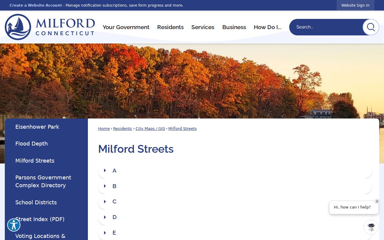
The official street-list capture is the safer reference when a historical abbreviation needs to be compared with a current street choice.
Check a Milford Street ZIP
ZIP geography belongs after the address has been normalized. USPS established 06461 effective July 1, 2005 for a portion of deliveries previously served under 06460. Current USPS material uses the preferred city label MILFORD CT 06460 for the pair, while Milford city records can carry either code depending on the address field. A ZIP is a routing label, not a municipal parcel boundary.
Use USPS By Address to verify a specific delivery result. MapXpress has no ZIP field, so a street dropdown is better for a parcel browse. Civil Inquiry's property-address form accepts a five-digit ZIP, but it returns case-address associations within limited categories and dates, not every parcel or name in the ZIP. The ZIP-specific route is covered in the Milford ZIP directory.
Milford Address Records Need Limits
Some address facts will never appear in a public street directory. People who are not owners and other household members may not be named in the property roll. DMV address data is restricted by the Driver's Privacy Protection Act. Voter files have purpose and redistribution limits. Safe at Home can suppress an actual street address. Courts, vital records, and police files can be sealed, redacted, or withheld.
Lawful personal use. Milford street and address records can support genealogy, house history, civic research, and fraud defense. Connecticut stalking and harassment law does not permit a public record to be used for repeated targeting, threats, or intimidation.
A street directory should also avoid publishing unnecessary identifiers. Record the source date, field name, parcel ID, and record type. If the question shifts from a whole street to one person, use the Milford resident lookup workflow and preserve each source's narrower meaning.
Milford Address Counter and FOIA
Online search is only the first access channel. The City Clerk counter at 70 West River Street, Room 107, supplies staff help, copies, and certification. The Assessor answers parcel questions at 203-783-3215. Milford's central FOIA form can route a specific permit, tax, voter, or departmental record to the office that holds it. Police records use a separate request form. Library staff can retrieve directories, microfilm, maps, and yearbooks by appointment.
When a page, fee, image, or coverage year changes, check the official custodian before relying on a result. SearchIQS image or account behavior may differ from the guest entry, and the City Clerk's current fee page controls copies and certifications. The street directory is strongest when it shows the direct portal, the counter fallback, and the limits together.